
Campus GIS
Mission
The mission of the San Diego State University Campus GIS is to provide access to, understanding of, and spatial context for a range of data utilized in the operation of SDSU facilities and services. In addition, the effort is providing learning opportunities for SDSU’s students.
Departments Served
Business and Financial Affairs
- Administration
- Environmental Health and Safety
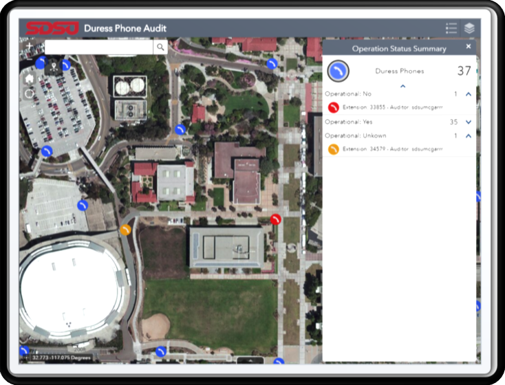
- Public Safety / SDSU Police Department
- Business Operations
- Facilities Services
- Real Estate, Planning and Development
- Facilities Planning, Design and Construction
- Project Management
Academic Affairs
- Office of the Associate Vice President for Academic Affairs
Campus GIS Infrastructure
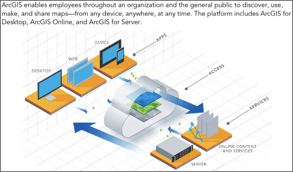
SDSU’s campus GIS utilizes Esri’s ArcGIS Enterprise platform to store, access, visualize, analyze, and serve multiple geographic information systems (GIS) data layers, airborne imagery sets, and digital surface/terrain models. Data may be accessed using web/mobile geospatial apps for ease of use, and/or desktop installations of ArcGIS software.
Campus GIS Participants
Staff, faculty, and students of the Geography Department include: Pete Coulter, Harry Johnson, Dave McKinsey, Marcus Chiu, Piotr Jankowski, Douglas Stow, Garland McNew, Andy Loerch, Nevin Valles, Vincent Ohararhi, Teresa Ramos, Ken Tominaga, Empress Holiday, Nikki Kojima, Jeremy Schaefer, Allie Paquette, Eva Sanchez, Caleb Bombaci, Cody Sherman, Bailey Schrader, and Jacob Daoust.
Additional Information
Any questions or comments may be directed to Pete Coulter or (619) 594-6973.